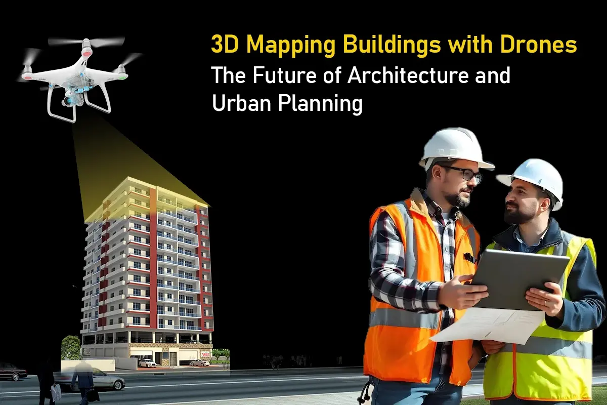
Architecture, real estate, and urbanism have indeed radically changed in the last few years thanks to 3D mapping buildings with drones. Technology has developed over it, allowing the use of drones for efficiently and accurately creating 3D models of structures with amazing details. This method helps UAVs produce data-enriched views through less error and maximum productivity on the construction and planning phase.
The whole idea behind 3D mapping buildings using drones, the many benefits it brings along and how the information is processed from drone to 3D model will be discussed comprehensively in this guide, its advantages, and the drawbacks for the future of the industry.
Understanding 3D Mapping with Drones
It is a system of creating three-dimensional embodiments of real-world sites. In referring to 3D mapping of buildings with drones, we will refer to UAVs armed with high-resolution cameras and LiDAR technology for aerial imaging and data collection. These aerial pictures are processed to create a digital model for various applications, from urban planning to historical preservation.
How Drones Work in 3D Mapping
Drones equipped with specialized cameras and sensors fly over the designated area in a grid pattern. They capture vertical and oblique photographs, and with the help of software, these images are stitched together to create a comprehensive and detailed model. The transformation from drone to 3D model involves complex algorithms that interpret the collected data, generating a visual representation usable by architects, engineers, and city planners.
Advantages of 3D Mapping Buildings with Drones
1. Cost-Effectiveness: Traditional surveying usually demands much time, manpower, and equipment. In comparison, drone 3D mapping buildings is a much cheaper option that cuts down on labor costs and the length of time taken in considering data collection.
2. Accuracy: Drones are capable of capturing images precision-wise without fault. The resulting 3D models are highly detailed, so decisions made in the designing and construction process are based on real data.
3. Timeliness: Working with drones, which are very efficient at mobilizing over large stretches of terrain, also implies that survey work gets completed much faster. Whereas with conventional means the processing might take days or weeks, the same could often be done within a matter of hours using UAV technology.
4. Safety: Drones enhance safety in 3D mapping buildings by enabling the survey of hard access locations without the risk of sending workers into unsafe areas.
5. Data-Rich Collections: Aside from images, drones also collect topographical data, which are essential for land-use planning, landscaping, and environmental assessment projects.
Key Technologies Behind Drone 3D Mapping
UAVs: The Heart of 3D Mapping
UAVs are significant in the process of making a 3D model. Different sensors and cameras are used, from RGB cameras for taking color photographs to thermal cameras for heat mapping to LiDAR sensors for precise measurements. This way, various types of data are collected that could be essential for the construction and planning processes.
The Role of Software in 3D Mapping
The software is a complex, highly specialized application that is used to convert raw drone data into usable models, including Pix4D, DroneDeploy, and RealityCapture. This software allows users to import drone-captured images and process them into digital models. Several analyses, such as topographic mapping, volumetric calculations, etc., can also be performed on these platforms.
Applications of 3D Mapping in Various Industries
Architecture and Construction
Aerial drone 3D mapping of buildings is widely used in architects and construction firms for project planning, monitoring, and execution. The continuous access to accurate models can help these professionals change their minds according to real-time data and thus improve the overall quality of their work.
Real Estate
High-quality 3D models made from drone data can really augment listings in real estate. Buyers receive immersive visualizations of properties that give extensive information beyond traditional photographs, allowing for more informed choices.
Urban Planning
Urban planners can utilize UAV-based mapping for a better way to assess land use and also visualize the same. Diversity in quickly making or modifying models can help planners know what beauty exists in making the city smarter, more efficient, and greener.
Environmental Management
At the same time, drones can bring 3D mapping building with drones to environmental management-having studies of deforestation, urban sprawl, and changes specifically in biodiversity. This analysis is critical for properly managing ecological resources sustainably.
Process of Creating 3D Models using Drones
Step 1: Planning the Flight
Good drone 3D mapping of buildings involves proper flight planning. The operator will have to analyze the selected area to be mapped, prepare proper flight paths, and take care of compliance depending upon his area of operation.
Step 2: Data Acquisition
All during the flight, images are taken by the drones at predefined intervals. The quality and resolution of cameras will greatly influence the quality of the 3D model, and hence, in addition to the type of UAV, selection of sensors will also be critical for collecting high-quality data.
Step 3: Data Processing
After the collection of data, operators will stitch images together using proprietary software. These steps involve working with algorithms to turn the pictures into a coherent 3D model.
Step 4: Analysis and Dissemination
This final model is more than a representation; it can be analyzed for any number of processes. Interoperable formats allow interested stakeholders to view data and interact with it, ushering into a collaborative environment for decision-making.
Case Studies of Successful Drone Mapping
Case Study 1: Urban Development in Chicago
Constructed buildings in Chicago, with 3D mapping buildings using drones, as the construction company advances toward developing a city within the urban setting. The data obtained from it was then analyzed through drones, accurately visualizing city layouts with stakeholder integration for new development locations and saving the time process from weeks to days.
Case Study 2: Historical Site Preservation
In the face of the decline of the historical building, a team preservation took to using UAV technology for 3D mapping buildings using drones. Detailed models were produced that illustrated architectural features and enabled 3D renderings for restoration purposes. The workflow from drone to 3D model guaranteed accuracy and detail for sensitive types of restoration.
Future Trends in Drone 3D Mapping
Technological advancement has welcomed several emerging trends in 3D mapping buildings with drones. Innovations in AI and machine learning complemented by advances in drone capabilities will enable us to make even more detailed 3D models and faster processing times.
Greater accessibility and affordability of drones are also expected to open the doors for smaller companies and independent consultants to have their share in this technology, thus making it available in a wide-range of sectors.
Privacy and Regulatory Considerations
The popularity of 3D mapping buildings with drones is likely to escalate the debate on privacy and regulatory issues. Stakeholders will have to navigate this expansive challenge, ensuring that the affected parties comply with local laws while maintaining their trust.
Conclusion
With the use of 3D mapping buildings with drones set within the contexts of modernization, it can no longer be called a trend since in fact it has been changing industries in the way they plan and design. Drones are invaluable tools that offer great insight, which can, in turn, enhance decision-making procedures. With the affordable, accurate, and fast methods at the disposal of drone technology, the future seems very promising indeed for so many applications toward increased efficiency and cluster innovation.
Impactful ramifications of 3D mapping buildings with drones are here to stay; this new technology will encourage a budding paradigm of helping us visualize and engage with our surroundings in the built environment. More opportunities to engage in critical applications-from urban planning to environmental management-will be realized as we embrace its revelations.
FAQs
1. What accuracy can be achieved from mapping buildings in 3D with drones?
The accuracy really depends upon several factors like drone quality, camera resolution, and flight heights. Followed by this, modern technology may already give you an accuracy of a few centimeters.
2. Do I need any special permission to carry out drone surveying in 3D?
Yes, in most countries, certain rules are compulsory, and a license is required for commercial transactions. The rules vary by country, and it is vital to verify local regulations when using a drone for commercial purposes.
3. Anything is OK for the 3D mapping of buildings with drones, do I put a specific brand on a certain drone?
Not all drones can perform 3D mapping buildings with drones. In this sense, it is essential to pick drones that are meant for mapping applications; this basically means that they equip very good cameras and good sensors.