SKylanIT

The Role of GIS in Smart Cities Shaping The Future of Urban Development

The Role of GIS in Smart Cities

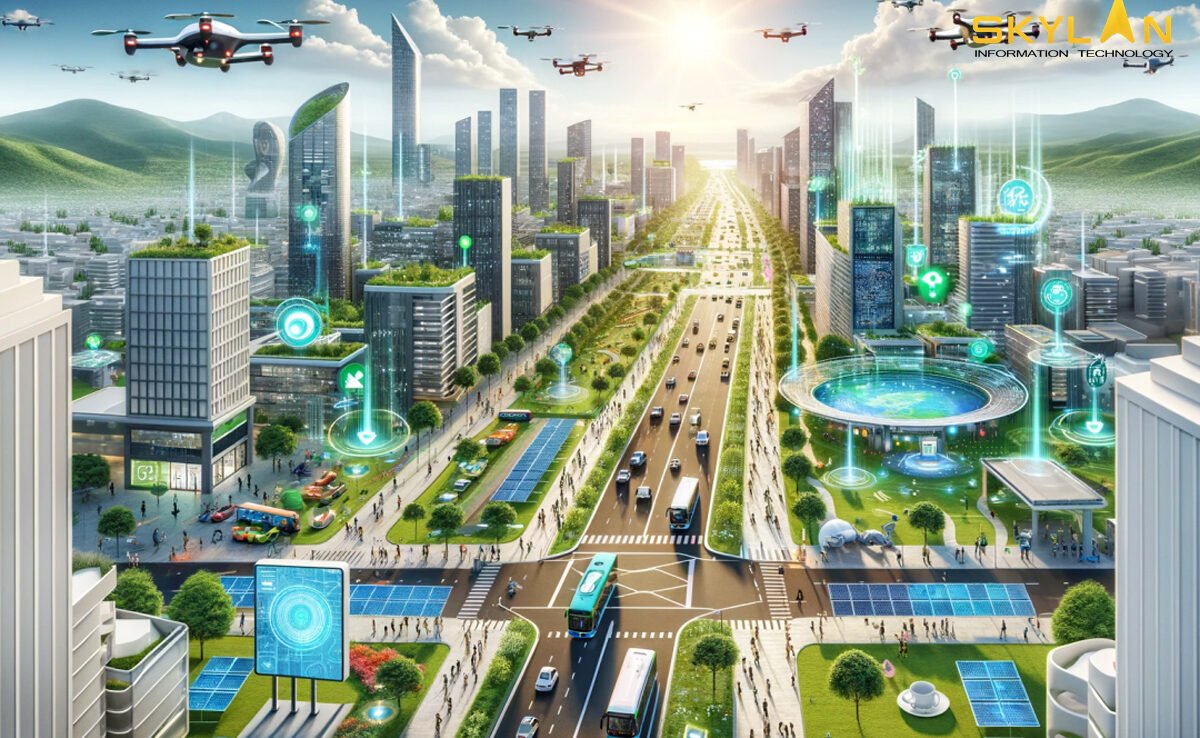
Introduction The concept of smart cities is rapidly changing the way urban spaces are designed and managed. Smart cities use technology to improve everything from transportation to energy usage, improving the quality of life for residents while reducing the environmental impact. But all this can’t happen without the use & help of GIS (Geographic Information Systems). GIS is not just limited to digital maps, it’s a complete system that helps capture, analyze, and visualize geographic data. For smart cities, GIS helps in planning, implementing, and managing urban infrastructure and services. In this blog, we discuss the role of GIS in smart cities, and how it’s used to address urban challenges, and its’ potential to shape the future of urban development. Understanding GIS and Smart Cities Geographic Information Systems (GIS) is a technology that helps in capturing, storing, analyzing, and visualizing geographic data. This data can be anything related to a location, such as roads, buildings, vegetation, or even population density. What makes GIS unique is it allows users to see patterns, relationships, and trends. For example, a city planner can use GIS to map out the locations of schools, hospitals, and public parks in a city, and then analyze how well these services are distributed across different neighborhoods. This helps in making informed decisions about where new infrastructure should be built to meet the needs of the population. A smart city uses technology and data to improve urban services, and makes them more efficient, sustainable, and responsive to the needs of residents. Key features of smart cities include sustainability, efficiency, and use of technology like sensors, IoT, and big data analytics to monitor and manage urban services. Smart cities aim to solve common urban problems like traffic issues, pollution, and inefficient energy use. By collecting and analyzing data in real-time, these cities can make in decisions that will surely improve daily life for their citizens. Smart city technologies can include smart grids for energy management, intelligent transportation systems, and real-time air quality monitoring. GIS is necessary for making smart cities because it helps in combining and analysing huge amounts of geographic data from various sources. This c data is used to create detailed maps and models that help in urban planning, infrastructure management, environmental monitoring, and more. In smart cities, GIS helps authorities to visualize and improve the layout of city. GIS allows city planners and decision-makers to analyze how different parts of the city interact, from traffic patterns to the availability of green spaces, and makes data-driven decisions that improve the urban environment. Applications of GIS in Smart City Development GIS plays a key role in urban planning by providing detailed maps and data that help city planners to make informed decisions. Planners can use GIS to create 3D models of buildings, roads, and infrastructure, which helps in visualizing future developments. For example, GIS can show how a new housing development will affect traffic patterns or how close it is to places like hospitals and schools. This will ensure that cities grow in a planned and organized way, and overcrowding is avoided. Urban infrastructure like that of roads, and public services, can be monitored and managed e with GIS. By mapping the location of water pipes, electrical grids, and transportation networks, city authorities can monitor their condition in real-time and plan maintenance more efficiently. GIS also helps in optimizing resources by identifying areas where new infrastructure is needed and avoids costly overlaps or delays. Managing traffic is a major challenge in cities. GIS helps in analyzing traffic patterns, planning public transportation routes, and reducing congestion. By laying down traffic data on a city map, authorities can identify best routes for buses, trains, and other public transports. This also reduces emissions and energy consumption by promoting more efficient transport systems. Smart cities prioritize sustainability, and GIS plays an important role in achieving this. GIS is used to monitor pollution levels, manage natural resources, and track environmental changes. For example, GIS can map out areas that are at risk of flooding or deforestation, thereby helping cities to plan for and reduce its harmful environmental impacts. It’s also used to monitor air quality and ensure that cities meet their sustainability goals. In smart cities, GIS improves public safety by improving emergency preparedness and response. Real-time data from sensors, cameras, and GPS devices is fed into GIS systems to provide a clear picture of an emergency. This allows emergency services to plan the fastest routes, identify the most affected areas, and coordinate resources more effectively, eventually saving lives and reducing damages. Challenges and Considerations One of the biggest challenges in implementing GIS in smart cities is integrating diverse data sources. Cities generate huge amount of data, bringing all this data together into a single GIS system requires careful planning and coordination. The quality of the data also matters; inaccurate or outdated data can lead to flawed decisions. With the increased use of geographic data in smart cities, privacy and security concerns becomes important. GIS systems collect large amounts of location based data, this data could be used to track sensitive information of individuals. So it is extremely important that this data is securely stored and managed. Implementing GIS technology can be expensive, especially in small or developing cities. The cost of acquiring and maintaining GIS software, hardware, and skilled labours is high. And sometimes lack of technical experts in small cities can also limiting its accessibility. The Future of GIS in Smart Cities The future of GIS in smart cities is getting influenced by Artificial Intelligence, Machine Learning, and the Internet of Things (IoT). These technologies are making GIS more powerful and efficient. As smart cities develop, the ability to analyze real-time data will become more important. This will allow cities to respond to problems more quickly and make data-driven decisions on the fly. Another trend is the use of 3D mapping in GIS. Conclusion GIS is playing a key role in shaping future of smart cities. It provides the data and

GIS

Introduction to GIS for Beginners: Understanding the Basics and Getting Started

It’s not easy to navigate a new city without Google Maps or finding the fastest route home without a GPS. Maps are very important tools in our daily lives. Whether it’s planning a road trip or monitoring the environment, geographic information is required everywhere. This is where GIS, or Geographic Information Systems, comes in. It’s a powerful technology that helps us make sense of geographic data and is used in many industries, from urban planning to business logistics. In this blog, we will tell about GIS in simple terms, explain its basic concepts, applications, and how you can get started. By the end of this guide, you will understand the components of GIS, its importance, and the steps you can take to explore this exciting field. 1. What is GIS? Geographic Information Systems (GIS) is a system that captures, stores, analyzes, and visualizes geographic data. Think of it as a way to understand and work with data that is linked to a specific location on the Earth. For example, GIS can help us map traffic patterns, analyze population growth, or study environmental changes. GIS takes information about places, such as coordinates or addresses, and links it with data about what is happening at those places like the population size or land use. This information is collected from various sources, including satellites, surveys, and GPS devices. GIS software then processes this data, allowing us to view it on maps and analyze it. By doing so, we can see patterns, make decisions, and solve problems related to geography. GIS is important in today’s world because it helps us make sense of complex geographic data. From government planning to environmental conservation, GIS is used for making correct decisions. For example, city planners use GIS to design infrastructure, while environmental scientists use it to track wildlife habitats. Businesses also depend on GIS to improve delivery routes, find the best locations for new stores, and study ongoing market trends. 2. Key Components of GIS GIS is made up of several important components that work together to collect, process, and display geographic data. These components include hardware, data, software, people, and methods. Hardware means the physical tools/equipment needed to run a GIS, like servers, computers, and GPS devices. These devices are used for collecting geographic data like a GPS recording the location of a place and store it for further analysis. GIS software are the tool that processes and analyzes the collected data. There are several types of GIS software available, with some of the most popular ones being ArcGIS, QGIS, and Google Earth. These software allow users to input geographic data, run analyses, create maps, and visualize the results. ArcGIS is widely used for advanced GIS applications, while QGIS is a free, open-source option that’s great for beginners. GIS data comes in two forms one is spatial data and other is attribute data. Spatial data includes information about where things are, such as coordinates, boundaries, or roads on a map. Attribute data provides additional information about those places, like population density, land use, or rainfall levels. Together, these types of data give a complete picture of geographic areas. People are an important part of GIS. Skilled professionals, such as GIS analysts, gather and analyze geographic data to solve problems and make decisions. They use their expertise to interpret the data and create meaningful solutions, whether it’s for city planning, environmental management, or disaster response. Methods refer to the techniques and processes that are used for collect, analyzing, and presenting GIS data. This can involve using GPS devices to record locations, running spatial analysis to find patterns, or using remote sensing to monitor environmental changes. Each method plays an important role in making GIS effective. 3. Common Applications of GIS GIS is used in a variety of fields and industries to improve decision-making and solve real-world problems. Some common applications include urban planning, environmental management, disaster management, and business analytics. 4. Getting Started with GIS If you’re new to GIS and want to explore this field, there are several steps you can take to get started. 5. Challenges and Tips for Beginners Like any technology, learning GIS comes with its challenges, but with persistence and the right resources, you can overcome them. 6. The Future of GIS Conclusion In this blog, we’ve covered the basics of GIS, its key components, and how it’s used in different industries. Whether you’re interested in urban planning, environmental conservation, or business analytics, GIS offers valuable tools to understand and analyze geographic data. If you’re interested in field of GIS, start by choosing a GIS software, learning the basics through online courses, and trying out beginner projects. GIS is becoming increasingly important in many industries, and by gaining skills in this area, you’ll be prepared to solve real-world problems and explore exciting career opportunities.

Geographical-Datas-Use-in-Research

Geographical Data’s Use in Research on Climate Change

Currently, one of the most urgent issues is climate change. The challenges posed by climate change call for creative answers. The use of geospatial data is essential to understanding these intricacies. This post examines the various ways that geospatial data which includes satellite data, GIS technology, spatial analysis, and more contributes to our understanding of climate science. What is Geospatial Data? It refers to information that describes characteristics and actual location of Earth’s features. The benefit of geospatial data is that it is easily accessible in real time, allowing researchers to keep up with changing weather patterns. This temporal component turns out to be crucial, particularly in a society where prompt and informed reactions are required due to rapid environmental shifts. Geospatial data is the foundation of analysis in the context of climate change research since it provides accurate location information and captures subtle differences across landscapes. The interactions between environmental variables—ranging from variations in temperature to shifts in land use—are carefully documented in the geospatial domain. What are various types of Geospatial Data? Geographical data comes in a variety of forms, each with a special application. These kinds of data provide unique insights into the study of climate change, improving our capacity to assess, forecast, and adapt to changes in the environment. Raster Data: Raster data is organized into a grid of pixels that displays variables like temperature, precipitation, and land cover that are continuous. Its ability to portray gradual variations is crucial for monitoring climate changes over time and space. Raster data includes images from satellites, drones and various other camera sensors.  Vector Data: Vector data uses a combination of points, lines, and polygons to define its spatial properties.. For showing distinct entities like boundaries, roads, and infrastructure, it is perfect. Vector data is useful for creating adaptation tactics and locating susceptible locations in climate studies. Climate Science and GIS Technology Geographic Information Systems (GIS) technology allows the mapping, processing, and display of geographical data, which is beneficial to climate science. In climate research, GIS is used to guide decisions about resource management, disaster preparedness, and environmental conservation. In addition to making mapping and visualization easier, GIS makes it possible to analyze geospatial data in a comprehensive way. GIS acts as a compass in the huge ocean of climate research, helping to locate climatic hotspots and evaluate the effects of environmental changes. GIS is being used in climate studies outside of academic settings. GIS is used in urban planning to help create climate-resilient cities. GIS aids in anticipating and reducing the effects of extreme weather events in disaster management. These uses highlight the revolutionary potential of GIS technology in creating a future that is climate resilient. Environmental Mapping Visual representations of geographical data, such as maps that beautifully depict environmental changes, best showcase its power. Geospatial data-driven environmental mapping creates precise and perceptive depictions of how ecosystems are affected by climate change. Consider a map that shows how urbanization is encroaching on formerly unspoiled areas. These maps can be used by environmentalists and legislators to support conservation initiatives by highlighting the pressing need for sustainable land-use practices. These maps’ visual appeal resonates with a wider audience and motivates group action outside of the scientific community.   Satellite Data for Research on Climate High-orbiting satellites are essential for giving a worldwide view on changes connected to climate change. These satellites, which are fitted with cutting-edge sensors, record vital data such as changes in sea level, rates of deforestation, and temperature fluctuations. Comprehensive, large-scale observations are made possible by the combination of satellite data with climate studies, which deepens our understanding of the complex interactions between Earth’s systems. Take the monitoring of polar ice melt using satellite data, for example. Scientists are able to monitor the polar ice caps’ decline, which provides vital information for climate models that forecast increasing sea levels. This practical use demonstrates how crucial satellite data is to determining how we will respond to climate change.   Spatial Analysis in Climate Research Advanced spatial analysis methods are needed to reveal the hidden patterns in geospatial data. By using techniques like overlay analysis, clustering, and interpolation, scientists can learn more about how climate-related occurrences are distributed geographically. Think about using geographic analysis to forecast the distribution of vector-borne illnesses that are impacted by climate change. Researchers can avert possible health crises that climate change may intensify by proactively implementing targeted therapies based on an analysis of the geographic distribution of these diseases. Thus, spatial analysis becomes one of our most important tools in the fight against the negative effects of climate change on human health. New developments in real-time data collecting have been brought about by technological advancements in climate monitoring. Sensors and Internet of Things (IoT) devices are constantly sending in data on the weather and air quality. This technology enables a dynamic system for monitoring and reacting to changes in our climate when it is seamlessly combined with geographical data. Geographical Approaches to Climate Change Climate studies heavily rely on solutions like remote sensing technology, which operate from a distance using satellites or aircraft. Remote sensing provides important information for comprehending the effects of climate change, from tracking the polar ice caps to evaluating the health of the vegetation. A powerful collection of geospatial solutions to address climate change concerns is formed by the convergence of GIS, satellite systems, and advanced mapping technologies. These solutions provide a full plan of action, from vulnerability mapping to the development of focused mitigation and adaptation plans   Conclusion By working together and using the knowledge gained from geospatial data, we can overcome the obstacles posed by climate change and prepare the way for a resilient and environmentally conscious future.  

6 Most Common GIS

The 6 Most Common GIS Mistakes People Make

We will discuss the top 6 GIS errors that people make in this post based on my personal observations and experiences. Whether you’re a seasoned GIS expert or you’re just getting started, knowing these traps will help you improve your skills and save you time and stress. Now let’s go straight in and discover the realm of GIS errors as a team. What Does a GIS Error Mean? Any variation or disparity between the observed or recorded data and the true or expected values within a spatial dataset or analysis is referred to as an error in the field of Geographic Information Systems (GIS). Errors can occur at many stages of the GIS workflow, from data collection and processing to analysis and interpretation, and they can take many different forms. Types of GIS Errors Errors in Data Acquisition Measurement inaccuracies These mistakes, which can include inaccurate GPS readings or careless surveying methods, happen when gathering geographical data. Errors in Sampling: Sampling errors can arise while gathering data from a subset of a larger population if the sample is not representative of the population as a whole, producing biased findings. Data Entry Mistakes: Errors can be introduced into GIS datasets by human data input mistakes such as typos, misinterpretations, or omissions. Errors in Data Processing: Georeferencing Mistakes: Aligning spatial data with a known coordinate system is known as georeferencing. Georeferencing errors may cause features in a map or dataset to be misaligned or displaced. Digitalization Mistakes Converting analog or paper maps into digital versions is known as digitizing. The accuracy of spatial data can be distorted by digitization errors such as feature misplacement, underrepresentation, or simplicity. Interpolation Mistakes: Values between known data points are estimated using interpolation techniques. Assumptions on the continuity of the data or improper interpolation methods might result in interpolation errors. Mistakes in Data Analysis: Statistical Mistakes Quantifying geographical patterns, correlations, and trends is a key component of statistical analysis in GIS. Inaccurate model assumptions, sample biases, or unsuitable statistical tests are examples of errors in statistical analysis that can produce inaccurate results. Errors in Modeling GIS models mimic occurrences or processes found in the actual world. Oversimplification, parameter uncertainty, or a lack of thorough comprehension of the underlying processes can all lead to errors in modeling. Algorithmic Mistakes: Algorithms are used by GIS software to carry out different spatial operations and analysis. Incorrect results or outputs might arise from mistakes in the design or implementation of an algorithm. Typical Errors in GIS Low-quality data Any GIS project depends heavily on data, and the quality of that data can have a big impact on the dependability and precision of analysis and decision-making. Sadly, a lot of GIS users undervalue the significance of high-quality data, which can skew their findings and cause biases and inaccuracies. Inaccurate information, inconsistencies, and inaccuracies are common problems with data quality. GIS users need to have strong data quality assurance procedures in place, such as procedures for data validation, cleansing, and updating, in order to reduce these risks. Users can increase the legitimacy and efficacy of their GIS projects by guaranteeing the accuracy and consistency of their data. There are a lot of internet repositories for GIS data these days. To guarantee data quality, the majority of the datasets on some of these repositories need to be closely monitored. Ignoring Projections and Coordinate Systems Many people are always perplexed by this topic. Although coordinate systems and map projections are fundamental ideas in GIS, users frequently ignore or misunderstand them. In GIS analysis and visualization, using the wrong or mismatched coordinate systems can lead to spatial distortions, misalignments, and errors. GIS users need to become familiar with various coordinate systems and projections and choose the right ones for their projects in order to avoid making this error. Users may preserve the quality and integrity of their GIS outputs by making sure spatial data is projected and referenced correctly. Absence of Version Control and Regular Backups Have you ever gathered data in the outdoors only to find that by nightfall, your gadgets are empty? could possibly possess inaccurate or lacking data? This has happened to several users. For GIS projects, data loss or corruption can be disastrous, sometimes resulting in expensive rework, delays, or even project collapse. However, a lot of GIS users don’t put in place sufficient version control and backup procedures, leaving their data susceptible to unanticipated events or human mistake. Users should set up frequent backups and version control systems to protect against data loss and guarantee data integrity. Users may confidently track the progress of their projects and recover lost data by keeping backup copies of their GIS datasets and monitoring changes over time. Bad Visualization and Map Design Although maps are effective tools for conveying geographical information, poorly designed and visualized maps can mask rather than highlight key findings. Avoid typical hazards such as cluttered layouts, unsuitable symbology, and deceptive representations while using GIS. Users should follow the visual hierarchy, simplicity, and clarity of cartographic design principles in order to make maps that are effective. Users may improve the readability and interpretability of their maps and make sure the audience understands the intended message by using the right colors, symbols, and labeling approaches. Ignorance of Security and Privacy Issues In the current era of growing concerns about data security and privacy, GIS users need to secure sensitive data and take precautions against exposure or unauthorized access. Inadequate privacy and security measures may give rise to data breaches, privacy violations, or legal ramifications. GIS users should give data encryption, access controls, and adherence to pertinent privacy legislation first priority in order to allay these worries. Users can safeguard individual privacy rights and foster a sense of trust and confidence in their GIS systems by taking a proactive approach to privacy and security. Insufficient Instruction and Professional Growth To fully utilize GIS technology, users need to stay up to date on the latest advancements and industry best practices, which are always changing. Unfortunately,

Necessary GIS Skills

Necessary GIS Skills for a Successful Career

GIS skills are becoming more and more valuable in today’s dynamic labor market, and finding use in a wide range of industries. It is important that you acquire the necessary abilities, whether you plan to make a career in GIS or not. Professionals in geographic information systems (GIS) are necessary in a variety of businesses for their work in mapping, evaluating spatial data, and resolving challenging issues. It is necessary to grasp fundamental GIS skills if you want to succeed in this fast-paced sector.   Developing specialized competencies can improve your career prospects and make you a sought-after professional in the geospatial business, regardless of your role—GIS developer, analyst, or technician. Identifying the Most in-demand GIS skills The field of GIS is vast and sometimes unclear. A user may wonder what matters and what doesn’t. Let’s discuss the fundamental GIS skills you’ll need to function in this flexible profession. Technical expertise: Using GIS software, such as QGIS and Esri, among others, is the first essential skill for GIS experts. This skill has a lot to teach us. concentrating not just on GIS software but also on other work-assisting technologies and automation systems. Among many other things, you can concentrate on spatial analysis, data visualization, and manipulation. Technical abilities that are also important include learning how to create spatial datasets and understanding a variety of data formats. Analytical Thinking in geographical data: Professionals in GIS that are successful have developed their critical thinking abilities with reference to geographical data. To make judgments and resolve challenging spatial issues, they are able to examine spatial data and imagery. Professionals in geographic information systems (GIS) are adept at identifying patterns, trends, and relationships in spatial data and can interpret this information to make deft decisions. They can display and analyze data using GIS technology, and they can use the data to make informed decisions. 3. Flexibility: Considering how quickly GIS methods change, flexibility is essential for GIS practitioners. To have a deeper comprehension of the patterns and relationships in the environment around them, they must be able to use spatial data. Analyzing skills: To guide decisions and solve problems, GIS developers require excellent analytical abilities to understand and analyze spatial information and imagery. Data interpretation, analysis, and presentation to GIS and non-GIS users are the responsibilities of developers. In the field of GIS, they should possess strong talents. 5. Good Communication skills: In a GIS job, effective communication is essential. Effective communication skills and a wide understanding of management principles enable GIS specialists to manage projects effectively and provide decision-makers with strategically important information. 6. Innovation: One soft skill that might help GIS developers is creativity. It enables them to take an inventive approach to problem-solving and geographical data display. The Most important Skills for GIS Developers The skill requirements for GIS developers are slightly higher than those for a typical GIS user role. Esri is the most frequently used skill set among GIS developers, with C++ and ArcGIS Server following closely. Ideally, a variety business elements, including industry, environment, and personal experience, influence the skills needed. Along with the previously mentioned skills, the following are also highly looked after skills; Management of Databases and SQL Languages Used for Programming: Python, Java, R Web Mapping Artificial Intelligence and Machine Learning Geospatial Intelligence Management of Spatial Data Furthermore, the GIS business places a great priority on the soft skills covered above. The Benefits of GIS Knowledge in Education With the help of GIS, students can create maps, infographics, and web mapping apps while also developing critical spatial thinking, problem-based learning, and media fluency. It also fosters in pupils an interest and a drive for lifelong learning in the field of GIS education. GIS is a valuable tool that teachers can use to support students’ growth in critical thinking, problem-solving, and spatial literacy. Because GIS allows students to acquire, analyze, and visualize data to have a better understanding of their surroundings, it also promotes students to become engaged citizens. The use of education to develop GIS Skills The dynamic aspect of GIS, which is always changing in sync with technology improvements, is what makes it so essential. Through hands-on learning, students develop a continuous improvement attitude that serves as a compass in the ever-changing world of GIS technologies. This kind of thinking turns into a motivating factor that helps students stay on top of trends, accept new technology, and adjust to the changing needs of the GIS sector. Students improve their critical thinking abilities through practical projects, growing in their capacity to analyze challenging geographic problems and come up with creative solutions. This  method converts  ideas into practical abilities, creating the groundwork for skilled GIS specialists. If someone wants to work in the geospatial industry, mastering the fundamentals of GIS is vital. To stay ahead in this dynamic and quickly changing industry, GIS experts need to constantly improve their technical proficiencies as well as their critical thinking abilities. Conclusion By developing these GIS skills, GIS professionals can make an important contribution to the evolution of geographic information systems and succeed in their current roles while having an important impact on a variety of industries and sectors.


    Commercial Drones at Your Finger's Tip. Enquire Now!
    Commercial Drones at Your Finger's Tip. Enquire Now!


      Select the fields to be shown. Others will be hidden. Drag and drop to rearrange the order.
      • Image
      • SKU
      • Rating
      • Price
      • Stock
      • Availability
      • Add to cart
      • Description
      • Content
      • Weight
      • Dimensions
      • Additional information
      Click outside to hide the comparison bar
      Compare

      Gis Solutions

      +(91) 0120-477-4898

      info@skylanit.com

      1st Floor D-77, Sector 63 ,
      Noida, 201301

      Main Offices

      Monday-Saturday: 9am-6pm

      © SkylanIT 2024, All Rights Reserved.