It’s not easy to navigate a new city without Google Maps or finding the fastest route home without a GPS. Maps are very important tools in our daily lives. Whether it’s planning a road trip or monitoring the environment, geographic information is required everywhere. This is where GIS, or Geographic Information Systems, comes in. It’s a powerful technology that helps us make sense of geographic data and is used in many industries, from urban planning to business logistics.
In this blog, we will tell about GIS in simple terms, explain its basic concepts, applications, and how you can get started. By the end of this guide, you will understand the components of GIS, its importance, and the steps you can take to explore this exciting field.
1. What is GIS?
Geographic Information Systems (GIS) is a system that captures, stores, analyzes, and visualizes geographic data. Think of it as a way to understand and work with data that is linked to a specific location on the Earth. For example, GIS can help us map traffic patterns, analyze population growth, or study environmental changes.
- How GIS Works?
GIS takes information about places, such as coordinates or addresses, and links it with data about what is happening at those places like the population size or land use. This information is collected from various sources, including satellites, surveys, and GPS devices. GIS software then processes this data, allowing us to view it on maps and analyze it. By doing so, we can see patterns, make decisions, and solve problems related to geography.
- Importance of GIS
GIS is important in today’s world because it helps us make sense of complex geographic data. From government planning to environmental conservation, GIS is used for making correct decisions. For example, city planners use GIS to design infrastructure, while environmental scientists use it to track wildlife habitats. Businesses also depend on GIS to improve delivery routes, find the best locations for new stores, and study ongoing market trends.
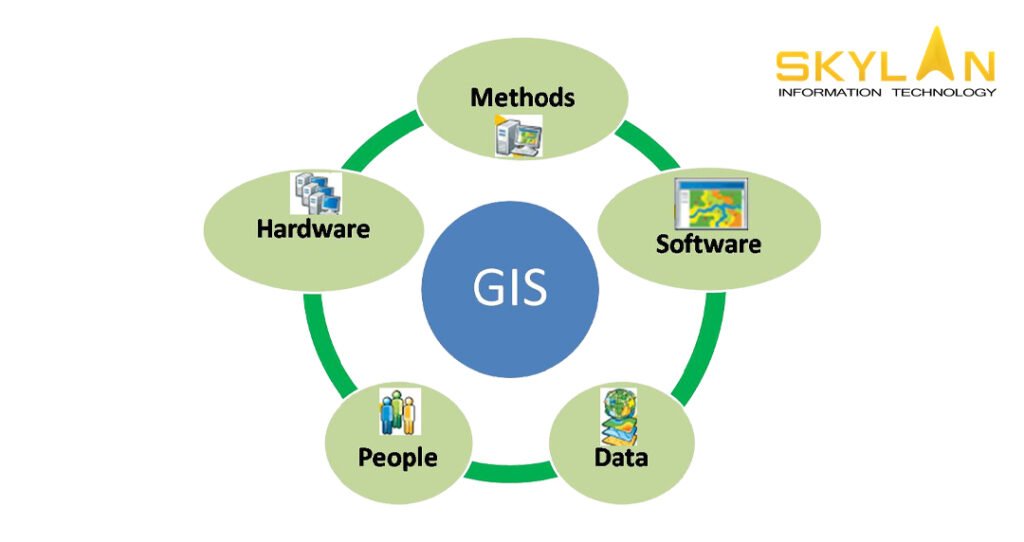
2. Key Components of GIS
GIS is made up of several important components that work together to collect, process, and display geographic data. These components include hardware, data, software, people, and methods.
- Hardware:
Hardware means the physical tools/equipment needed to run a GIS, like servers, computers, and GPS devices. These devices are used for collecting geographic data like a GPS recording the location of a place and store it for further analysis.
- Software:
GIS software are the tool that processes and analyzes the collected data. There are several types of GIS software available, with some of the most popular ones being ArcGIS, QGIS, and Google Earth. These software allow users to input geographic data, run analyses, create maps, and visualize the results. ArcGIS is widely used for advanced GIS applications, while QGIS is a free, open-source option that’s great for beginners.
- Data:
GIS data comes in two forms one is spatial data and other is attribute data. Spatial data includes information about where things are, such as coordinates, boundaries, or roads on a map. Attribute data provides additional information about those places, like population density, land use, or rainfall levels. Together, these types of data give a complete picture of geographic areas.
- People:
People are an important part of GIS. Skilled professionals, such as GIS analysts, gather and analyze geographic data to solve problems and make decisions. They use their expertise to interpret the data and create meaningful solutions, whether it’s for city planning, environmental management, or disaster response.
- Methods:
Methods refer to the techniques and processes that are used for collect, analyzing, and presenting GIS data. This can involve using GPS devices to record locations, running spatial analysis to find patterns, or using remote sensing to monitor environmental changes. Each method plays an important role in making GIS effective.
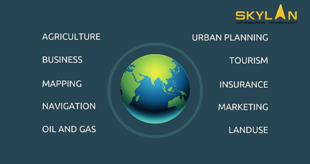
3. Common Applications of GIS
GIS is used in a variety of fields and industries to improve decision-making and solve real-world problems. Some common applications include urban planning, environmental management, disaster management, and business analytics.
- Urban Planning: In city planning, GIS helps with everything from zoning laws to infrastructure development. Planners use GIS to decide where to build new roads, parks, and public services. By analyzing geographic data, they can make informed decisions about land use and how to best accommodate a growing population.
- Environmental Management: GIS plays an important role in environmental conservation. It helps scientists monitor natural resources, track wildlife populations, and assess the impact of human activity on the environment. For example, GIS is used to study deforestation, track climate change, and manage natural reserves.
- Disaster Management: GIS is also used for managing natural disasters. It helps predict areas at risk of flooding, hurricanes, or earthquakes, and helps authorities to plan evacuations and coordinate emergency responses. By analyzing geographic data, rescue teams can decide the best routes for delivering aid and identify the most affected areas.
- Business and Marketing: Many businesses use GIS get a competitive edge in the market. Companies analyze geographic data to understand customer behavior, improve delivery routes, and choose the best locations for new stores. By mapping out demographic data, businesses can target marketing efforts more effectively and improve overall efficiency.
4. Getting Started with GIS
If you’re new to GIS and want to explore this field, there are several steps you can take to get started.
- Choosing the Right Software: The first step is to select the right GIS software. For beginners, QGIS is a good starting point because it’s free and user-friendly. ArcGIS is more advanced and offers powerful features, but it comes with a higher cost. Other options like Google Earth can also be useful for basic GIS tasks. Your choice to choose best software for your organisation will depend on budget, level of expertise, and needs.
- Learning Basic Skills: Once you have chosen your software, the next step is to learn how to use it. There are many online resources available, including tutorials, webinars, and courses. Websites like Coursera, Udemy, and Esri offer beginner-friendly GIS courses that teach the basics of spatial analysis and map creation.
- Practical Exercises: To build your skills, try simple projects like creating a basic map, analyzing local geographic features, or exploring population data in your area. These hands-on exercises will help you get comfortable with the software and develop a deeper understanding of how GIS works.
- Connecting with the GIS Community: Joining the GIS community can enhance your learning experience. There are online forums, social media groups, and local meetups where you can connect with other GIS learners and professionals.

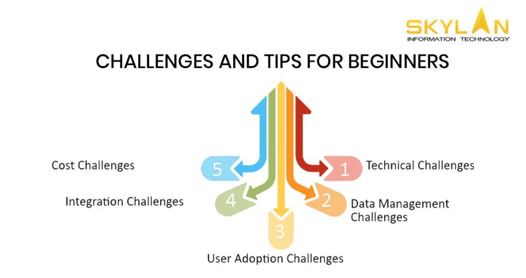
5. Challenges and Tips for Beginners
Like any technology, learning GIS comes with its challenges, but with persistence and the right resources, you can overcome them.
- Overcoming Technical Challenges: GIS software can be complex, especially for beginners. You can start with simple projects and then work on more advanced tasks. Online tutorials can help you in solving difficulties you face.
- Staying Updated: GIS technology is constantly evolving, with new tools and features being developed regularly. Stay up to date by following GIS blogs, reading industry news, and attending webinars.
- Resources for Continuous Learning: To deepen your GIS knowledge, explore books, websites, and online courses. Some recommended resources include the Esri Academy, GIS Lounge, and the QGIS website, which offers a wealth of learning materials.
6. The Future of GIS
- Emerging Trends: The future of GIS is bright, with exciting advancements on the horizon. Real-time data analysis, artificial intelligence integration, and 3D mapping are some of the emerging trends that are transforming the way we use GIS. These innovations will make GIS even more powerful and versatile in solving complex global challenges.
- Career Opportunities: GIS skills are in high demand across various industries. Career opportunities for those with GIS expertise include roles such as GIS analyst, urban planner, environmental consultant, and business intelligence specialist. Whether you’re interested in government, business, or environmental science, GIS offers a wide range of career paths.

Conclusion
In this blog, we’ve covered the basics of GIS, its key components, and how it’s used in different industries. Whether you’re interested in urban planning, environmental conservation, or business analytics, GIS offers valuable tools to understand and analyze geographic data.
If you’re interested in field of GIS, start by choosing a GIS software, learning the basics through online courses, and trying out beginner projects. GIS is becoming increasingly important in many industries, and by gaining skills in this area, you’ll be prepared to solve real-world problems and explore exciting career opportunities.