SkylanIT has years of experience in providing high-quality annotation and labelling services. We provide automated tools, human annotators to minimize curating fallout, and a strong workflow-driven platform to meet your training data demands.
Support for all annotation types
Bounding boxes and segmentation are created by our top-performing specialists using various AI-tools to meet training data requirements more quickly while maintaining the highest standards of quality, accuracy, and scalability. Our human-machine learning combo is made to address a wide range of use cases.
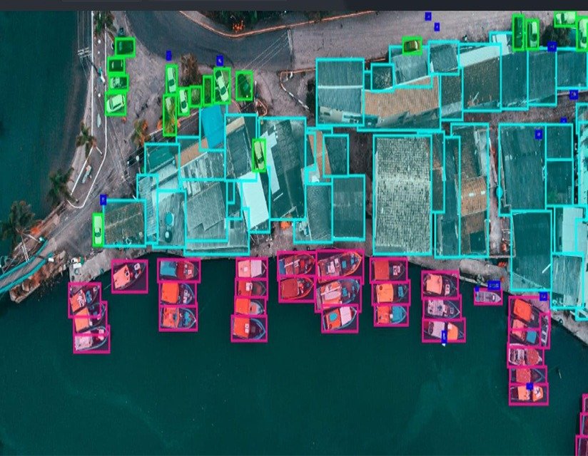
Bounding Boxes
In GIS, bounding boxes are rectangular annotations used to define the outer limits of a geographic object or feature. They help in marking the area of interest for further analysis, such as identifying buildings, vehicles, or land parcels in aerial imagery.
Polylines
Polylines are connected series of line segments that represent linear features in GIS, such as roads, rivers, or pipelines. We use these annotations to map and analyze infrastructure and natural paths, that help in navigation and planning.
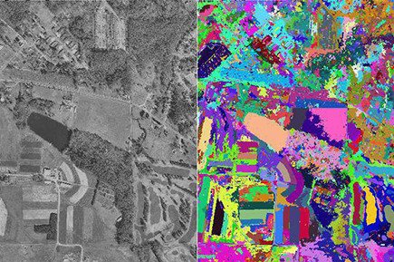
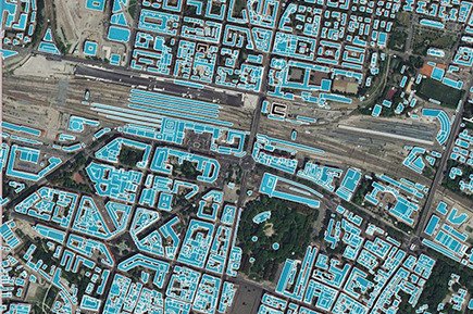
Semantic Segmentation
Semantic segmentation in GIS involves dividing an image into segments where each pixel is assigned a label corresponding to a specific geographic feature, such as water, vegetation, or urban areas. This technique enhances detailed spatial analysis and automated mapping.
Key Point Annotation
In key point annotation we mark specific, critical points within an image or map, such as landmarks, intersections, or tree locations. These annotations are used for precise geospatial referencing, and help in tasks like navigation, feature recognition, or 3D modelling.
Geo-Annotation
In Geo-annotation we add labels, descriptions, or metadata to specific geographic locations on a map. This can include information such as place names, land use, or environmental data, to improve the map’s utility for analysis and decision-making.