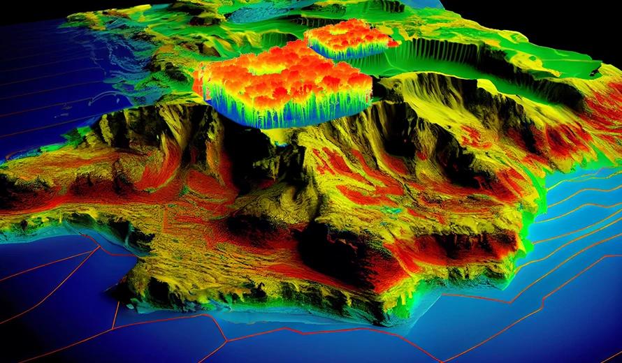
LiDAR mapping is a fast, cheap, and precise method of taking 3D scans of the Earth’s surface and its objects.
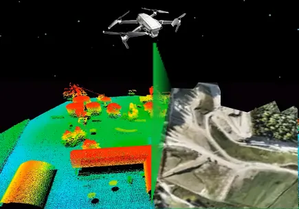
Lidar (Light Detection and Ranging) mapping is a remote sensing method. It uses pulsed laser to measure variable distances on Earth. And when this pulsed laser is combined with other data recorded by the airborne system. It generate accurate, 3D information about the shape of the Earth and its surface characteristics.
Lidar mapping
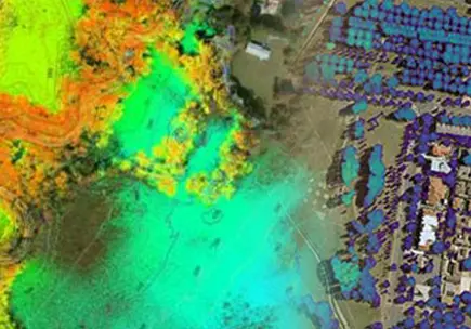
Lidar mapping is a powerful method for various applications, and it offering detailed and accurate spatial information. That supports different types of industries and research fields.
Solutions for LiDAR
SkylanIT supply data quickly and carry out accurate, fast surveys over huge areas of land. We also employ a group of skilled internal data processing specialists. We offer a range of LiDAR technologies to conduct vast area surveys for cities, forests, and mines. We have expertise surveying corridors for roads, pipelines,trains, electricity lines, and coastlines.
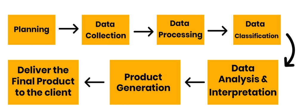
Steps Involved in Lidar Mapping
Uses/Applications of Lidar Mapping
- Forestry
- Archaeology
- Disaster Management
- ccc
- Transportation
- Mining
Advantages of Lidar Mapping
- High Accuracy
- Speed
- Automation
- Details
- Versatility
- Safety
Frequently asked questions
Which file format is supported for Lidar upload?
- JPGs format photos
- MRK .LDR, .CLC, .RTK, .RTS, .CMI, .RTL, (EVENTLOG), .IMU, .bin .CLI, extension files
- Atleast 1 GCP for published sites, and 2 for local sites.
Where is LiDAR mapping most used?
It is most useful in archaeology, mining, climate monitoring, city planning, meteorology, etc.


