-
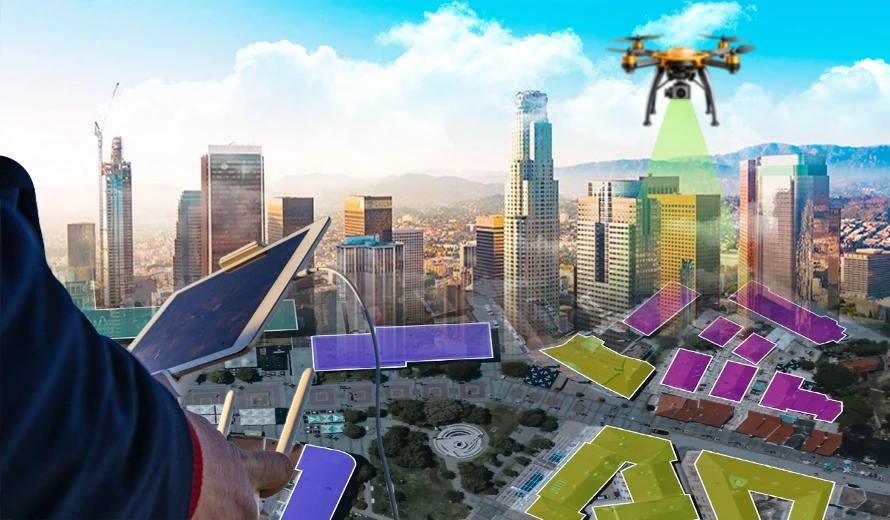
Drones
Eco Technology Revolutionizing industries with eco-friendly drone solutions for a sustainable future. Smart Tech Advanced drone technology designed for precision, efficiency, and innovation. Certified Expert Professional-grade drones crafted and supported by certified industry specialists. Premium Support Unparalleled customer assistance to ensure seamless drone operations. Explore More Why Choose Us Why Choose Us for Drone Solutions? Quality Guaranteed: All our drones are sourced from trusted manufacturers and rigorously tested to ensure top-notch performance and durability. Expert Support: Our team of drone specialists is here to guide you through your purchase and provide after-sales support to keep your drone flying smoothly. Competitive Pricing: Enjoy premium-quality drones at prices that fit your budget without compromising on features or reliability. Discover More What we offer Transform Your Business with Drone Innovation Revolutionize your business with innovative drone solutions designed to enhance efficiency and growth. Hybrid Drones Long-range delivery, mapping in hard-to-reach areas, and industrial inspections Fixed-Wing Drones Mapping, surveying, agriculture, and environmental monitoring. Sigma25 Sigma25 series is an under 2.8kg drone meant to have a perfect combination of portability and performance. These drones are qualified as ‘Survey Grade Drone’ by the Survey of India.
-
Annotation & Labeling
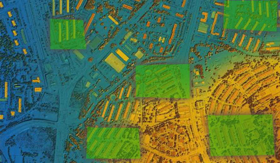
SkylanIT has years of experience in providing high-quality annotation and labelling services. We provide automated tools, human annotators to minimize curating fallout, and a strong workflow-driven platform to meet your training data demands. Support for all annotation types Bounding boxes and segmentation are created by our top-performing specialists using various AI-tools to meet training data requirements more quickly while maintaining the highest standards of quality, accuracy, and scalability. Our human-machine learning combo is made to address a wide range of use cases. Bounding Boxes In GIS, bounding boxes are rectangular annotations used to define the outer limits of a geographic object or feature. They help in marking the area of interest for further analysis, such as identifying buildings, vehicles, or land parcels in aerial imagery. Polylines Polylines are connected series of line segments that represent linear features in GIS, such as roads, rivers, or pipelines. We use these annotations to map and analyze infrastructure and natural paths, that help in navigation and planning. Semantic Segmentation Semantic segmentation in GIS involves dividing an image into segments where each pixel is assigned a label corresponding to a specific geographic feature, such as water, vegetation, or urban areas. This technique enhances detailed spatial analysis and automated mapping. Key Point Annotation In key point annotation we mark specific, critical points within an image or map, such as landmarks, intersections, or tree locations. These annotations are used for precise geospatial referencing, and help in tasks like navigation, feature recognition, or 3D modelling. Geo-Annotation In Geo-annotation we add labels, descriptions, or metadata to specific geographic locations on a map. This can include information such as place names, land use, or environmental data, to improve the map’s utility for analysis and decision-making.
-
Modeling Analytics
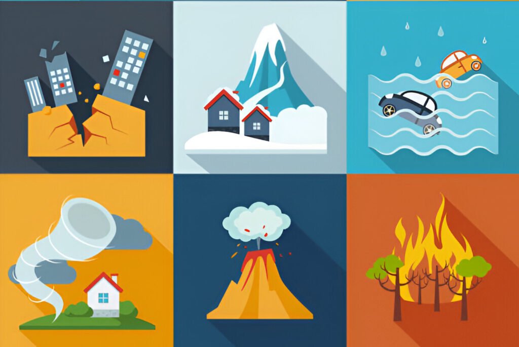
Natural Catastrophe (NAT CAT) Risk Modeling in GIS uses geographical data to assess, visualize, and predict the impact of natural disasters such as floods, earthquakes, hurricanes, or wildfires. By combining geographical data with hazard, exposure, and vulnerability information, GIS enables the identification of high-risk areas, helps in forecasting potential damage, and supports disaster preparedness and response planning. This modeling helps insurance companies, governments, and organizations evaluate risks, make informed decisions, and minimize losses from natural catastrophes. Models Our models provide a range of helpful outputs for planning mitigation strategies, developing insurance rates, assessing reinsurance protection plans, and other related tasks. Expertise Skylan has expertise in creating quantitative models to calculate possible losses because of man-made and natural hazards. We provide models that are based on historical event, physical hazards processes, exposures, local site circumstances, building and societal features, and historical damages. Modeling Hazards Cyclone Landslides Floods Weather Earthquakes Industrial Tsunami Droughts Fire Developing Exposures Population Agriculture Buildings infrastructure Livestock Understanding Vulnerabilities Physical Social Economic Assessment of Risks Event losses Average annual loss Loss Exceedance curves Risk maps Loss cost Risk profile report Mitigation options Benefit cost analysis Risk Analytics SkylanIT provide services like portfolio risk analysis, data mining, which includes temporal and spatial analysis, data cleansing and augmentation, and the creation of specialized analytical tools. Our services help the government, property, and insurance industries in managing the risks and portfolio databases.
-

Software in GIS
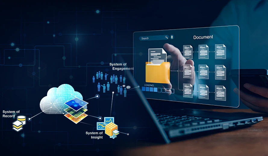
SkylanIT has years of experience providing GIS software consultancy throughout the whole software development life cycle. To provide value-added insights, such as a cost-benefit analysis of using different technologies, our experts carefully analyze the business model of the client, ensuring the best possible use of their infrastructure. Solutions for Data Management At Skylan we use several solutions to optimize the use and performance of GIS software, so that it meets the specific needs of different projects of clients. Application Software At Skylan we use several solutions to optimize the use and performance of GIS software, so that it meets the specific needs of different projects of clients. Enabling Tools & Automation Task Automation: Develop automated workflows to simplify data analysis and map creation. Tool Customization: Tailor GIS tools to suit specific operational needs, such as data conversion or terrain modeling. Maintenance and Support of Applications Regular Updates: It ensures the software is kept up-to-date with all the latest features and security patches. Issue Resolution: We provide ongoing technical support to resolve software-related issues promptly. Software Testing Quality Assurance: We test the software for functionality, performance, and compatibility before deploying it. Bug Fixing: Under it we identify & fix bugs to improve software stability and reliability. Technology Migration Skylan technology migration services support the easy movement of our client’s applications and guarantee an easy integration with their current systems. It includes these things: Platform Upgrades: It involves migrating GIS applications to newer platforms to improve performance and compatibility with modern systems. Data Transfer: It will ensure easy transfer of data and functionality during technology migration. System Modernization: It upgrades outdated software to new technologies, reducing operational risks. System Integration Skylan system integration services help businesses to accomplish their goals by integrating GIS with their enterprise applications. It includes: Cross-Platform Integration: in it we integrate GIS software with other systems like ERP or CRM to improve workflow efficiency. Data Sharing: It enables seamless sharing and analysis of data across different platforms and departments. Interconnection: Ensure that different software components work together smoothly within the GIS ecosystem. Enabling Tools & Automation For it Skylan uses these following methods: Project Management We use GIS software to track project progress in real-time. And monitor project resources, such as materials and labor, with geographical data. Workforce Management We use GIS tools to manage and allocate workforce resources based on geographic needs and automate scheduling of tasks such as data collection and fieldwork using GIS-enabled management systems. Document Management It enables users to query large GIS datasets effictively, and accessing relevant information quickly. It automates report generation based on query results for better decision-making. Query Management System It enables users to query large GIS datasets effictively, and accessing relevant information quickly. It automates report generation based on query results for better decision-making.
-
Imagery
In GIS, imagery means visual data captured by sensors mounted on satellites, drones, or aircraft that depict the Earth’s surface. This data includes photographs, infrared images, and other forms of visual representation that help capture geographic features and regions. Skylan imagery services are used to analyse land cover, area under vegetation, urban development, and various environmental conditions, offering a detailed view of geographical phenomena. It serves as an important input for map creation, analysis, and monitoring in a wide range of applications & industries. Solutions for GIS Imagery SkylanIT processes and improves GIS imagery by help of several advanced technologies that improve its accuracy and usability. Remote Sensing Skylan remote sensing services includes these following things Satellite Imagery: in this we capture images from space to monitor large-scale geographic features like forests, oceans, or urban growth. Data Analysis: Then we process and interpret remote sensing data to detect changes over time, such as deforestation or climate change effects. Multispectral Imaging: In this use images captured in different wavelengths (e.g., infrared) to analyze various aspects of the Earth’s surface Photogrammetry Skylan provides photogrammetry services for various sectors. In it we cover: Aerial Photography: Use images taken from aircraft or drones to measure distances, heights, and areas on the Earth’s surface. 3D Mapping: Creates three-dimensional models of landscapes by analyzing multiple overlapping images. Accurate Measurements: Extract precise geographic information from images for use in construction, urban planning, or environmental monitoring. LiDAR SkylanIT processes LiDAR dataset and delivers outputs in CAD & GIS format. Elevation Mapping: It uses laser technology to measure the height of objects and the Earth’s surface, provides detailed elevation data. High-Resolution Imaging: Generate high-resolution models of terrain, buildings, and vegetation. Topographic Analysis: Use LiDAR data for topographic mapping, flood risk assessment, and infrastructure planning.
-
Data Management
GIS data is spatial and non-spatial data that represents geographic features, like locations, shapes, and features of natural or man-made objects on the earth’s surface. This data can be in the form of maps, satellite images, coordinates, and tables that store information like population statistics of an area, land use, or environmental data. Data Conversion and Maintenance It’s important to convert data and maintain it for various purposes. Format Conversion: It involves converting data between different formats (e.g., CAD to GIS) for compatibility. Ongoing Maintenance: Regularly update and maintain data to ensure it remains accurate for long term. Quality Control: Verify the accuracy and consistency of the data after its conversion. Data Migration SkylanIT offers data migration of captured/collected GIS data it has these processes: System Upgrades: Migrate data from outdated systems to modern GIS platforms. Data Preservation: Make sure no loss of data happens during migration. Platform Integration: Integrate the migrated data with existing GIS workflows. Cartography & Mapping SkylanIT offers cartography mapping services to clients all over India. These services include map creation, specialized mapping and data representation Map Creation: In this we Design and develop maps that visualize geographic data effectively. Specialized Mapping: It involves creating thematic maps, like zoning or topographic maps, as per the needs of client. Data Representation: Ensure that the geographic data is represented clearly and accurately on maps. Conflation & Realignment SkylanIT uses the following steps for conflation & realignment of GIS data Data Merging: Datasets from multiple sources are combined, and common features like roads or boundaries are aligned. Error Correction: after that errors are Identified and removed from the data during the merging process. Dataset Alignment: Finally different datasets are aligned for consistent and reliable use. Consolidation & Integration SkylanIT combines data that is available from several places, formats, or sources into a single, complete GIS database while preserving the datasets visual appeal. This special service is commonly used for large-scale public sector data-sharing programs, private data content providers, and several departments within the same organization that use and/or are accountable for maintaining different aspects of the same master dataset. It’s benefits are: It lowers the costs of operating It increases efficiency and productivity It simpler to comply with data protection regulations and standards of any place It helps in creation of highly targeted advertisements using improved client data.


