3D Mapping Buildings with Drones: The Future of Architecture and Urban Planning
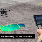
Architecture, real estate, and urbanism have indeed radically changed in the last few years thanks to 3D mapping buildings with drones. Technology has developed over it, allowing the use of drones for efficiently and accurately creating 3D models of structures with amazing details. This method helps UAVs produce data-enriched views through less error and maximum productivity on the construction and planning phase. The whole idea behind 3D mapping buildings using drones, the many benefits it brings along and how the information is processed from drone to 3D model will be discussed comprehensively in this guide, its advantages, and the drawbacks for the future of the industry. Understanding 3D Mapping with Drones It is a system of creating three-dimensional embodiments of real-world sites. In referring to 3D mapping of buildings with drones, we will refer to UAVs armed with high-resolution cameras and LiDAR technology for aerial imaging and data collection. These aerial pictures are processed to create a digital model for various applications, from urban planning to historical preservation. How Drones Work in 3D Mapping Drones equipped with specialized cameras and sensors fly over the designated area in a grid pattern. They capture vertical and oblique photographs, and with the help of software, these images are stitched together to create a comprehensive and detailed model. The transformation from drone to 3D model involves complex algorithms that interpret the collected data, generating a visual representation usable by architects, engineers, and city planners. Advantages of 3D Mapping Buildings with Drones 1. Cost-Effectiveness: Traditional surveying usually demands much time, manpower, and equipment. In comparison, drone 3D mapping buildings is a much cheaper option that cuts down on labor costs and the length of time taken in considering data collection. 2. Accuracy: Drones are capable of capturing images precision-wise without fault. The resulting 3D models are highly detailed, so decisions made in the designing and construction process are based on real data. 3. Timeliness: Working with drones, which are very efficient at mobilizing over large stretches of terrain, also implies that survey work gets completed much faster. Whereas with conventional means the processing might take days or weeks, the same could often be done within a matter of hours using UAV technology. 4. Safety: Drones enhance safety in 3D mapping buildings by enabling the survey of hard access locations without the risk of sending workers into unsafe areas. 5. Data-Rich Collections: Aside from images, drones also collect topographical data, which are essential for land-use planning, landscaping, and environmental assessment projects. Key Technologies Behind Drone 3D Mapping UAVs: The Heart of 3D Mapping UAVs are significant in the process of making a 3D model. Different sensors and cameras are used, from RGB cameras for taking color photographs to thermal cameras for heat mapping to LiDAR sensors for precise measurements. This way, various types of data are collected that could be essential for the construction and planning processes. The Role of Software in 3D Mapping The software is a complex, highly specialized application that is used to convert raw drone data into usable models, including Pix4D, DroneDeploy, and RealityCapture. This software allows users to import drone-captured images and process them into digital models. Several analyses, such as topographic mapping, volumetric calculations, etc., can also be performed on these platforms. Applications of 3D Mapping in Various Industries Architecture and Construction Aerial drone 3D mapping of buildings is widely used in architects and construction firms for project planning, monitoring, and execution. The continuous access to accurate models can help these professionals change their minds according to real-time data and thus improve the overall quality of their work. Real Estate High-quality 3D models made from drone data can really augment listings in real estate. Buyers receive immersive visualizations of properties that give extensive information beyond traditional photographs, allowing for more informed choices. Urban Planning Urban planners can utilize UAV-based mapping for a better way to assess land use and also visualize the same. Diversity in quickly making or modifying models can help planners know what beauty exists in making the city smarter, more efficient, and greener. Environmental Management At the same time, drones can bring 3D mapping building with drones to environmental management-having studies of deforestation, urban sprawl, and changes specifically in biodiversity. This analysis is critical for properly managing ecological resources sustainably. Process of Creating 3D Models using Drones Step 1: Planning the Flight Good drone 3D mapping of buildings involves proper flight planning. The operator will have to analyze the selected area to be mapped, prepare proper flight paths, and take care of compliance depending upon his area of operation. Step 2: Data Acquisition All during the flight, images are taken by the drones at predefined intervals. The quality and resolution of cameras will greatly influence the quality of the 3D model, and hence, in addition to the type of UAV, selection of sensors will also be critical for collecting high-quality data. Step 3: Data Processing After the collection of data, operators will stitch images together using proprietary software. These steps involve working with algorithms to turn the pictures into a coherent 3D model. Step 4: Analysis and Dissemination This final model is more than a representation; it can be analyzed for any number of processes. Interoperable formats allow interested stakeholders to view data and interact with it, ushering into a collaborative environment for decision-making. Case Studies of Successful Drone Mapping Case Study 1: Urban Development in Chicago Constructed buildings in Chicago, with 3D mapping buildings using drones, as the construction company advances toward developing a city within the urban setting. The data obtained from it was then analyzed through drones, accurately visualizing city layouts with stakeholder integration for new development locations and saving the time process from weeks to days. Case Study 2: Historical Site Preservation In the face of the decline of the historical building, a team preservation took to using UAV technology for 3D mapping buildings using drones. Detailed models were produced that illustrated architectural features and enabled 3D renderings for restoration purposes. The